Use CopPhil Data Explorer to find all Sentinel-3 Land Surface Temperature products over Manila in January 2024
Sentinel-3 sends a combination of optical, thermal, and altimetry sensors and those data can be used in a cross-disciplinary manner. Diverse groups of stakeholders – scientists, government agencies, urban planners, environmental organizations, and agricultural managers – can use those data as sent or can combine them with other satellite data.
Typical uses of Sentinel-3 Land Surface Temperature (LST) data are
Urban heat island (UHI) analysis
climate monitoring
agricultural and crop management
disaster management and health applications
infrastructure development and energy demand forecasting
water resource management
In this article, we cover an example of creating a search query for CopPhil OData API using CopPhil Data Explorer. We will be searching for all Sentinel-3 Land Surface Temperature products over Manila which were sensed in January 2024.
Prerequisites
No. 1 Access to Data Explorer
Login to Data Explorer with this link: https://explore.infra.copphil.philsa.gov.ph/search
You don’t need to be logged in to search for products.
However, you need to be logged in if you want to be able to download products.
If needed, refer to How to register and login to Data Explorer on CopPhil cloud
No. 2 Familiarity with searching for products on Data Explorer
You need to know how to use the search panel of Data Explorer: How to search for products using Data Explorer on CopPhil
No. 3 Familiarity with area of interest (AOI) on Data Explorer
We will use area of interest (AOI) to limit our search to products sensed around Manila. Learn more here: Area of interest as a means of limiting product search using Data Explorer on CopPhil
No. 4 Overview of available satellite instrumentation and capabilities
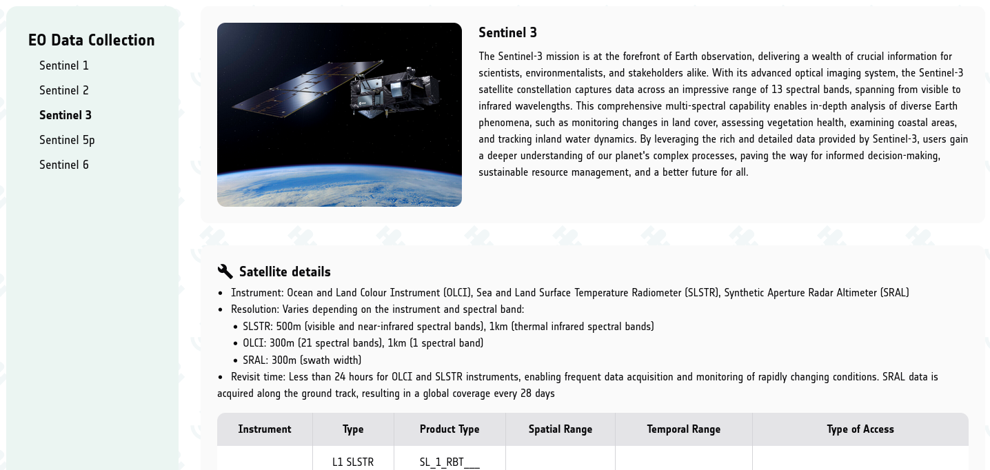
Page EO Data Collection shows information about the following satellites: Sentinel-1, Sentinel-2, Sentinel-3, Sentinel-5p and Sentinel-6.
In this article, we shall use only Sentinel-3:
What We Are Going To Cover
Filling in the search panel
Defining area of interest (AOI)
Copying query
Exploring the results
Step 1 Fill in the search panel
Assuming you have worked through Prerequisite No. 1, you will have Data Explorer open in your browser.
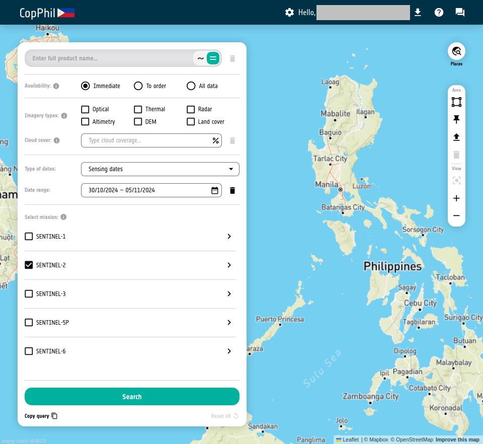
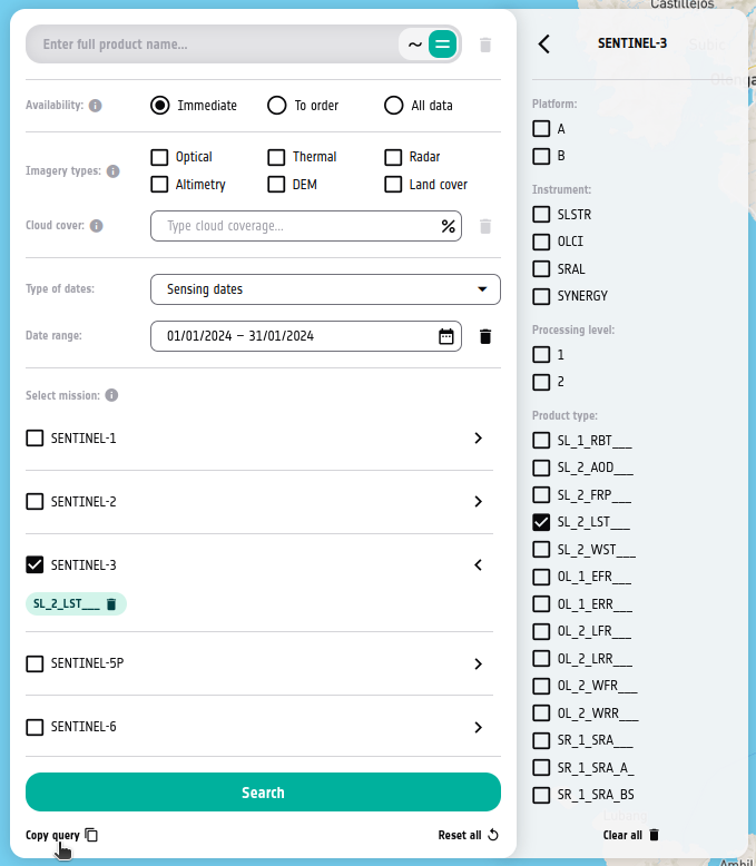
In section Select mission: of the search panel on the left of the page uncheck SENTINEL-2 and check SENTINEL-3. Make sure that only SENTINEL-3 is checked.
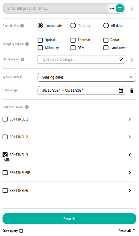
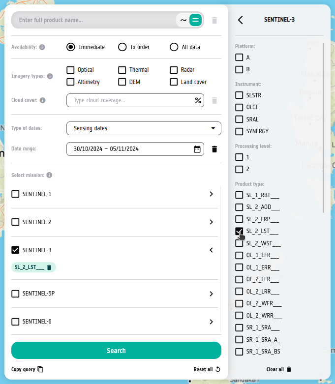
Checking SENTINEL-3 checkbox should reveal more options for this mission.
There, from section Product type: check SL_2_LST__
Make sure that in drop-down menu Type of dates: option Sensing dates is selected.
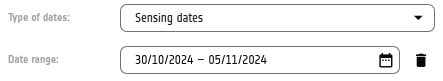
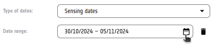
On the right side of field Date range, click the calendar icon.
To define time range for whole of January 2024, first navigate to that month. Click the left arrow enough times to get there:
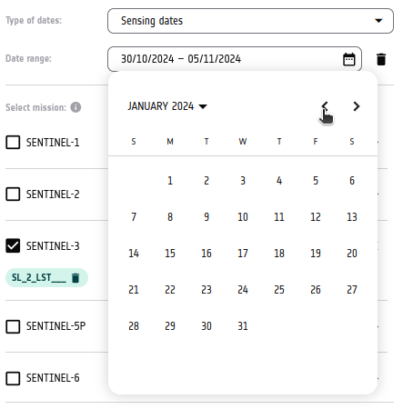
Once you are in that month, click the first and last day of this month, in that order.
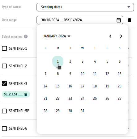
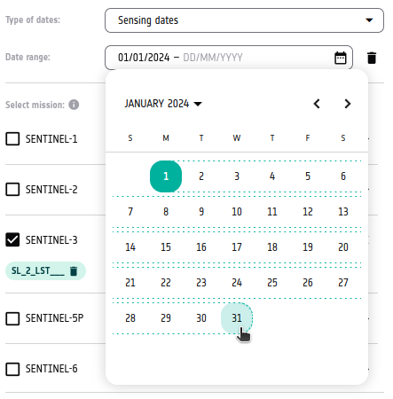
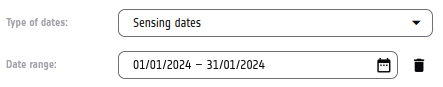
The field should now display the correct time range.
Step 2 Define area of interest (AOI)
From the bar on the right of the page, choose Draw polygon.
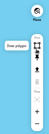
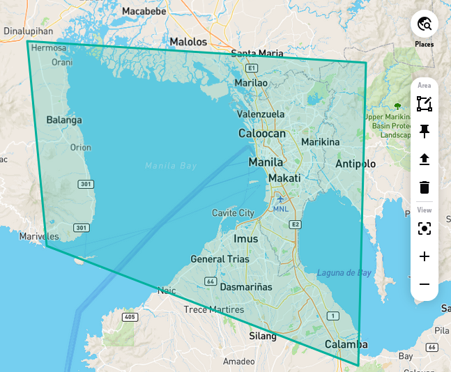
Create a polygon around Manila. Click on each of its points.
To learn more about specifying area of interest (AOI), check Prerequisite No. 3.
Eventually, you should get something like this:
Step 3 Copy query
Return to the search panel. In its bottom part, click Copy query:
The URL to CopPhil OData API containing your query should be copied to your clipboard.
While creating this article, the following URL was generated:
Step 4 Explore the results
Open the URL in the new tab or window of your Internet browser. You should see the results in JSON format.
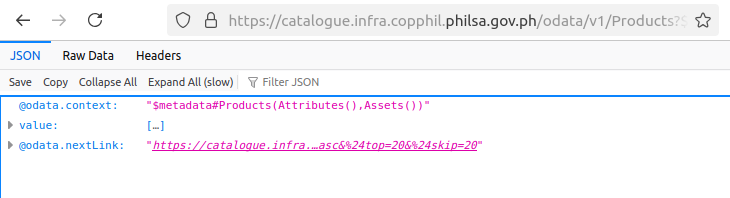
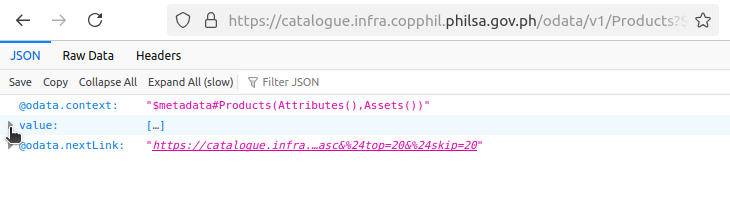
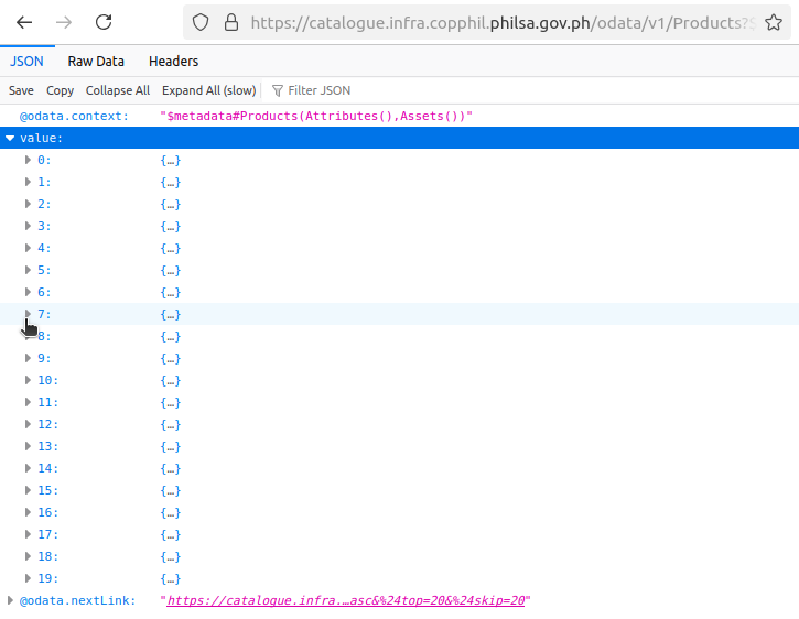
If you are using Firefox like in this example, you can click the arrow next to value to expand the results:
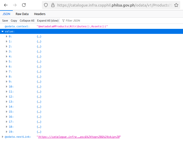
Top 20 results (ordered by sensing date ascending) were returned. To view more details about one of these results, expand it.
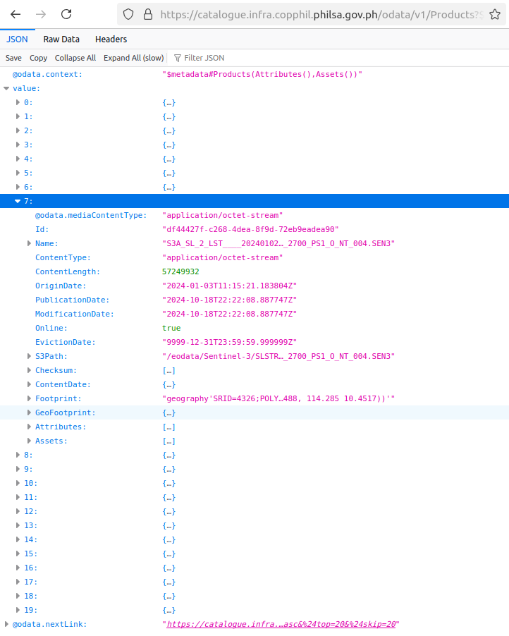
To view the next set of results, navigate to URL which is the value of key @odata.nextLink. In this example, it is:
What To Do Next
You can also use other satellites and their data to inspect conditions over Manila in a defined period of time. The following article uses Sentinel-2 LST data: